


Sob 8 ferte St Cyr bracieux

Glurps
User
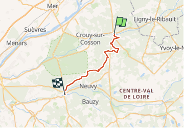

Length
26 km

Max alt
144 m

Uphill gradient
231 m
Km-Effort
29 km

Min alt
77 m

Downhill gradient
234 m
Boucle
No
Creation date :
2024-09-17 07:11:14.0
Updated on :
2024-09-17 14:59:59.849

FREE GPS app for hiking
 SityTrail
IGN / Geographical institutes
SityTrail Plus
The world is yours!
About
Trail of 26 km to be discovered at Centre-Loire Valley, Loir-et-Cher, La Ferté-Saint-Cyr. This trail is proposed by Glurps.
Photos


Positioning
Country:
France
Region :
Centre-Loire Valley
Department/Province :
Loir-et-Cher
Municipality :
La Ferté-Saint-Cyr
Location:
Unknown
Start:(Dec)
Start:(UTM)
400307 ; 5279179 (31T) N.
Comments